Notice of Committee Hearing
The Public is invited to participate in a Committee of Adjustment hearing on: Thursday, November 28, 2024, at 2:00 p.m.
How to participate:
Submit written comments, by emailing Fiona.Buchan@thunderbay.ca, no later than Wednesday November 20, 2024. Please quote the file number in your submission.
Participate online using Microsoft Teams. Online participants must register by the end of the day on Wednesday November 20, 2024. Please email Fiona.Buchan@thunderbay.ca to register
Attend in person, by visiting Council Chambers on the 3rd Floor of City Hall (500 Donald Street East)
Watch live from home by visiting www.thunderbay.ca/watchcouncil
Additional Information
If you wish to be notified of the decision of the Committee of Adjustment in respect of the proposed consent, you must submit a written request to Fiona.Buchan@thunderbay.ca.
Copies of all comments will be forwarded to the Committee and to the Applicant. The collection of personal information including names and contact information provided in written submissions is made under the authority of the Planning Act for the purpose of creating a Public Record. Personal information is collected in compliance with the Municipal Freedom of Information and Protection of Privacy Act.
Right to appeal
If a person or public body that files an appeal of a decision of the Committee of Adjustment, in respect to the proposed consent, does not make written submissions to the Committee of Adjustment before it gives or refuses to give a provisional consent, the Ontario Land Tribunal may dismiss the appeal.
Questions?
If you have any questions about this notice or you require accessible accommodations or materials, please contact:
Fiona Buchan
Committee of Adjustment Secretary-Treasurer
(807) 625-2538
Minor Variance Applications
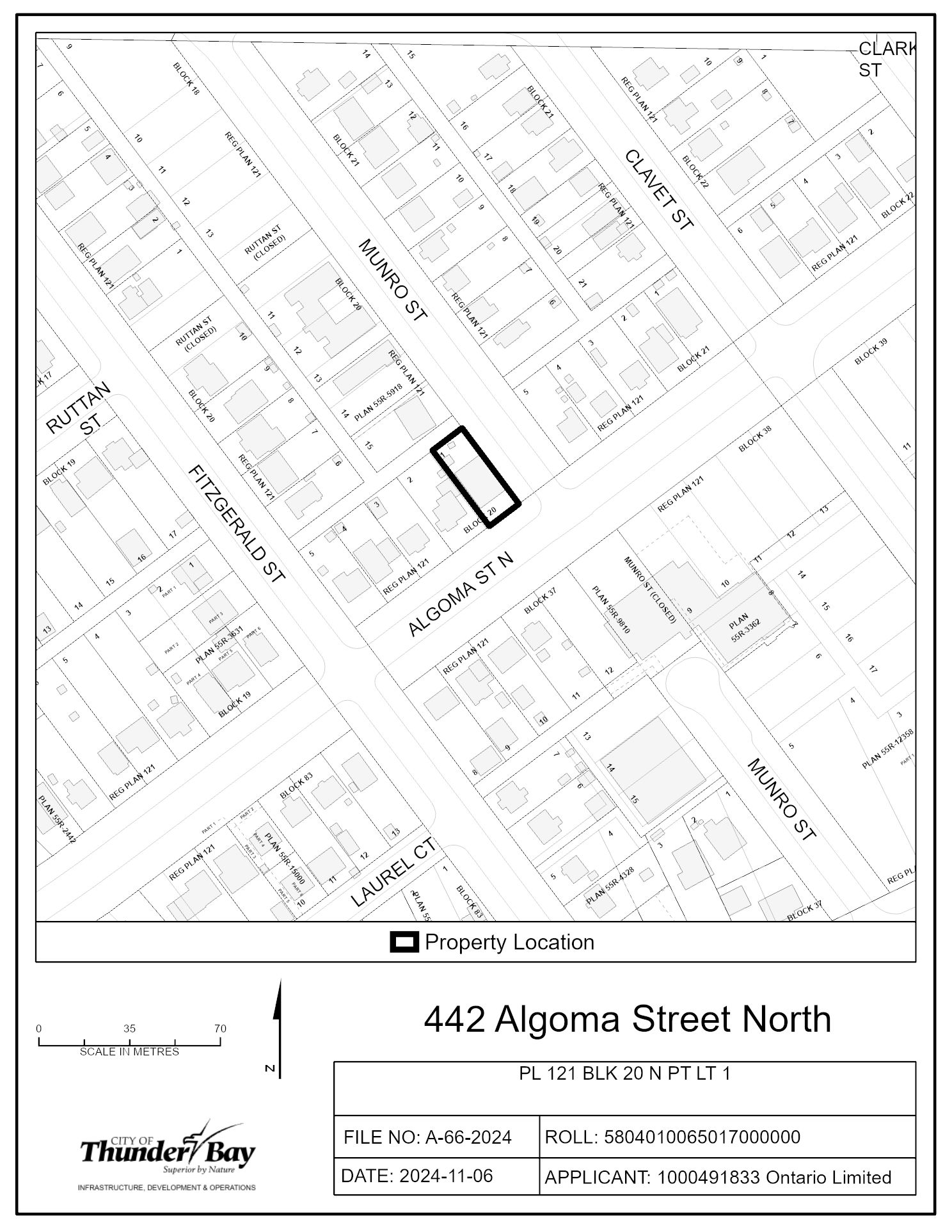
A-66-2024: 442 Algoma Street North
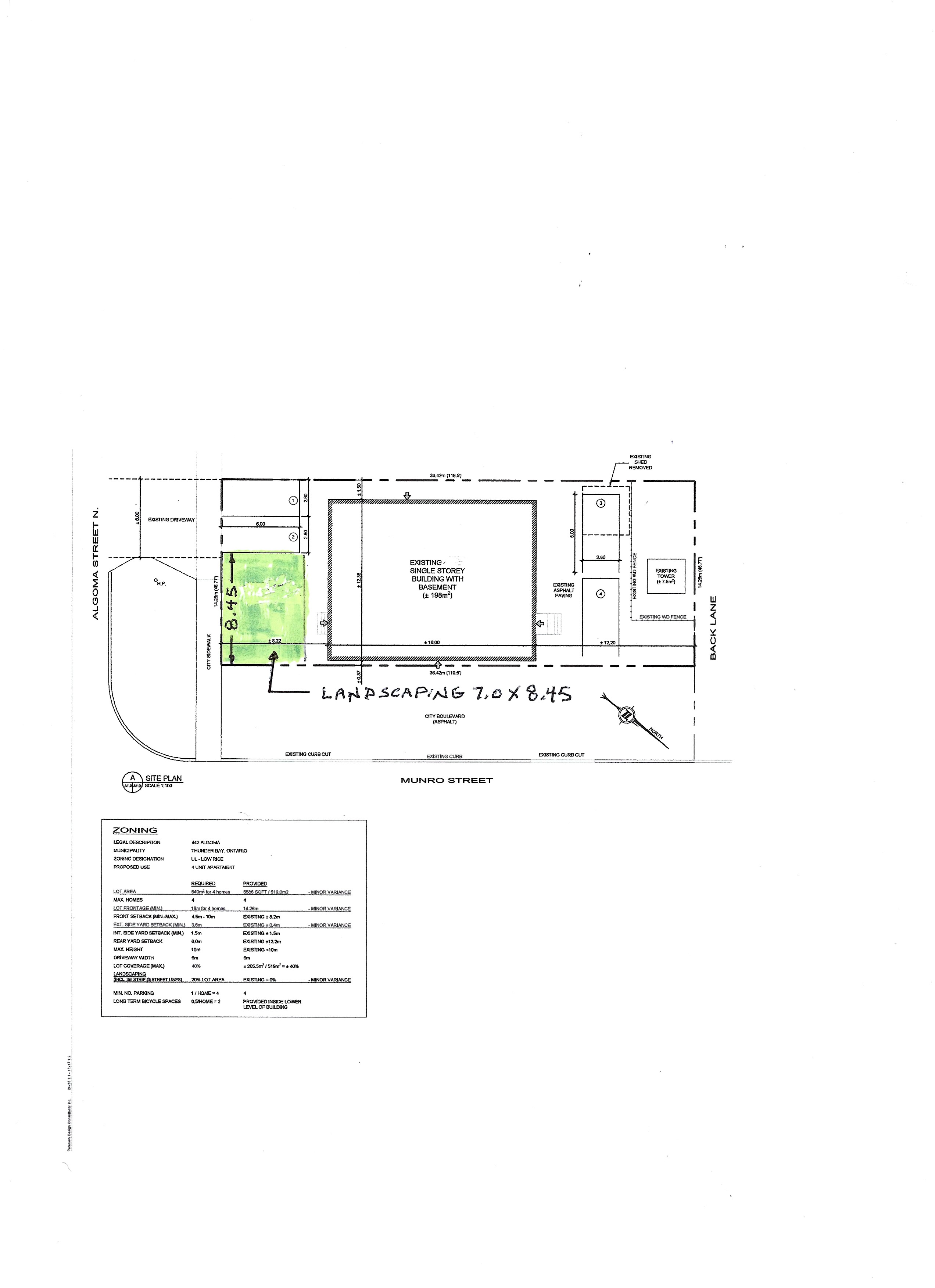
The purpose and effect of the application is to gain relief from Zoning By-law 1-2022 as set forth in the application and described below:
- Table 3.1.1 a
- Reduce the minimum lot frontage from 18 m to 14.26 m
- Reduce the minimum lot area from 540 m2 to 519.34 m2
- Table 3.2.1 c
- Reduce the minimum exterior side yard setback from 3.6 m to 0.37 m
- Table 3.3 b
- Reduce the minimum landscaping from 20% of the lot area and a 3 m strip along all lot lines abutting a street allowance to landscaping on 11% of the lot area and 0 m abutting a street allowance (Munro Street)
- Section 11.1.2 a
- Reduce the minimum distance of the driveway from an intersection from 9 m to 8.4 m on Algoma Street North
If approved, the effect of this application would be to add one additional rental unit to the residential apartment building.
The lands are zoned "UL" - Urban Low-rise Zone and are designated as "Residential" in the Official Plan. The applicant's site sketch and a key map of the subject lands are shown below.
The subject lands are not subject to any other application under the Planning Act at this time.
Key Map of Subject Lands
Applicant's Site Sketch
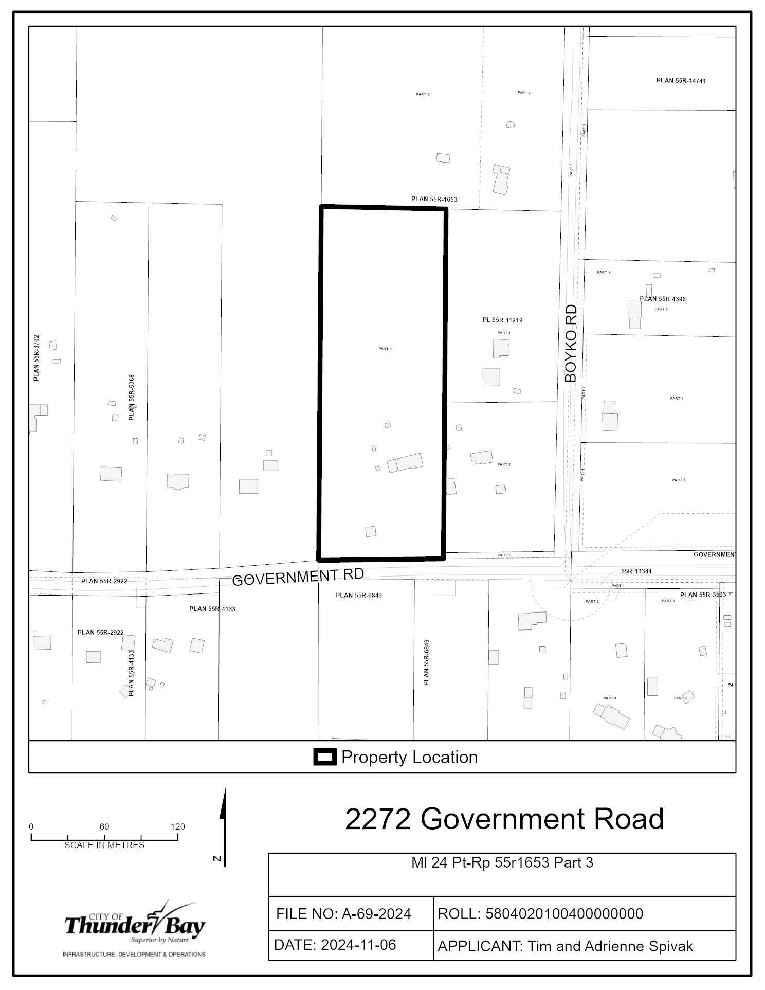
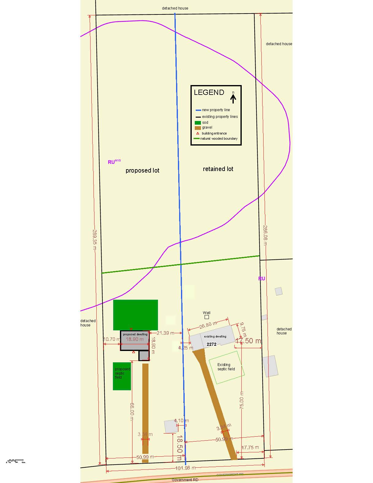
A-69-2024: 2272 Government Road
The purpose and effect of the application is to gain relief from Zoning By-law 1-2022 as set forth in the application and described below:
- Table 1.1.1.21
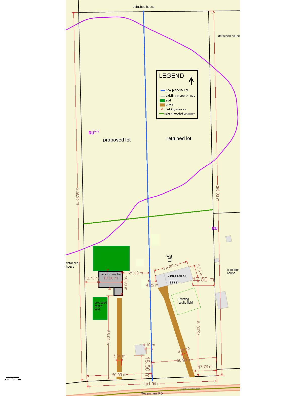
- Reduce the minimum lot frontage from 60 m to 50.99 m
- Table 1.2.1 b
- Reduce the minimum exterior side yard setback from the dwelling from 6.0 m to 4.25 m
- Table 1.2.2 b
If approved, the effect of this application would be to allow for the consideration of a severance for the construction of a new residential dwelling.
The lands are zoned “RU – Rural Zone” and “RUH15 – Rural Zone with Holding Provision 15” in the Zoning By-law 1-2022, and designated as “Rural” and “Natural Heritage” in the Official Plan. The applicant’s site sketch and a key map of the subject lands are shown below.
The subject lands are also the subject of an application for a consent, File no. B-68-2024, which is being considered concurrently by the Committee of Adjustment on November 28, 2024.
Key Map of Subject Lands
Applicant's Site Sketch
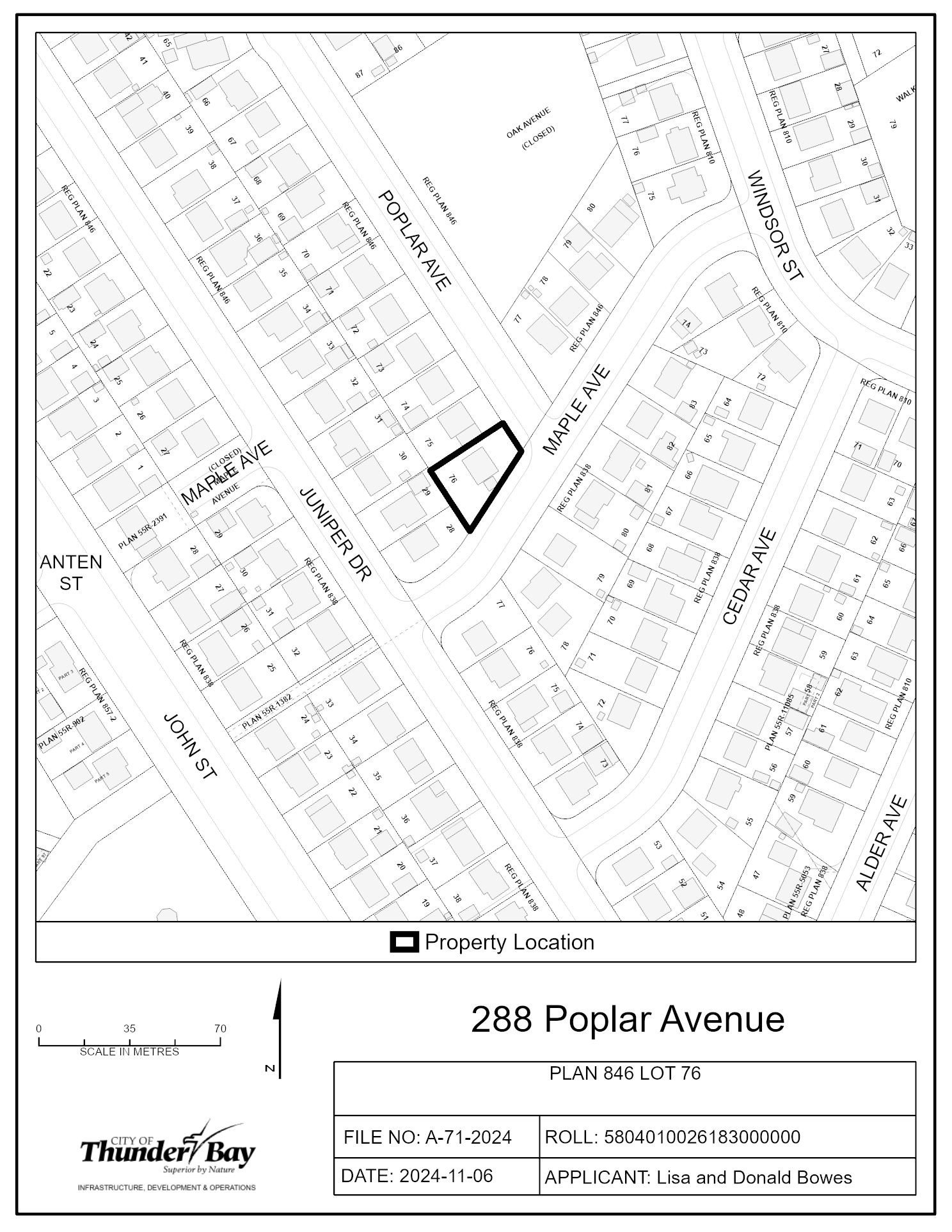
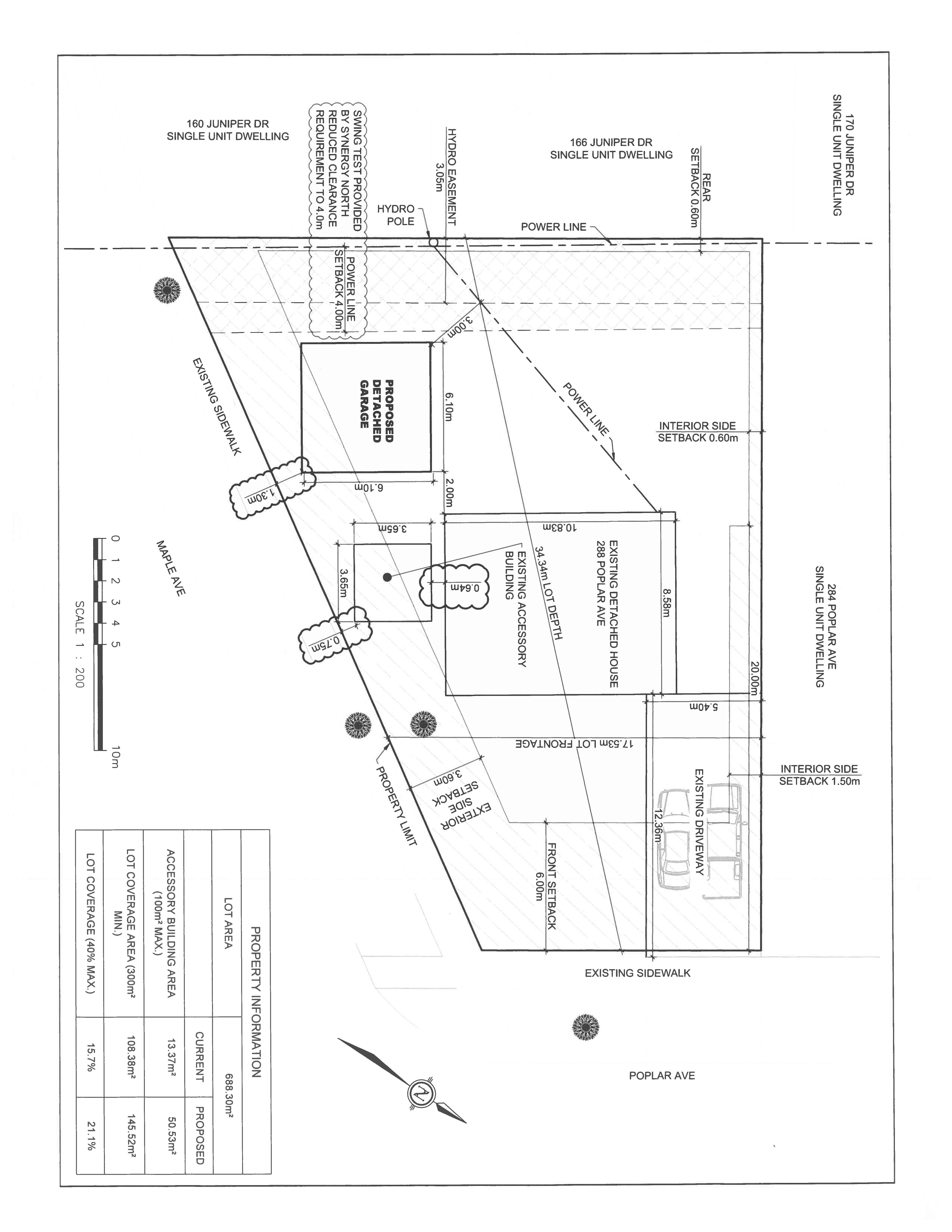
A-71-2024: 288 Poplar Avenue
The purpose and effect of the application is to gain relief from Zoning By-law 1-2022 as set forth in the application and described below:
- Table 3.2.2
- Reduce the minimum exterior side yard setback from 3.6 m to 1.3 m for the proposed accessory building
- Reduce the minimum exterior site yard setback from 3.6 m to 0.8 m for the existing accessory building
- Reduce the minimum separation distance between an accessory building and a main building from 2.0 m to 0.6 m
If approved, the effect of this application would be to allow for the construction of a new accessory building for storage, and to recognize the setbacks for the existing accessory structure.
The lands are zoned "UL" - Urban Low-rise Zone and are designated as "Residential" in the Official Plan. The applicant's site sketch and a key map of the subject lands are shown below.
The subject lands are not subject to any other application under the Planning Act at this time.
Key Map of Subject Lands
Applicant's Site Sketch
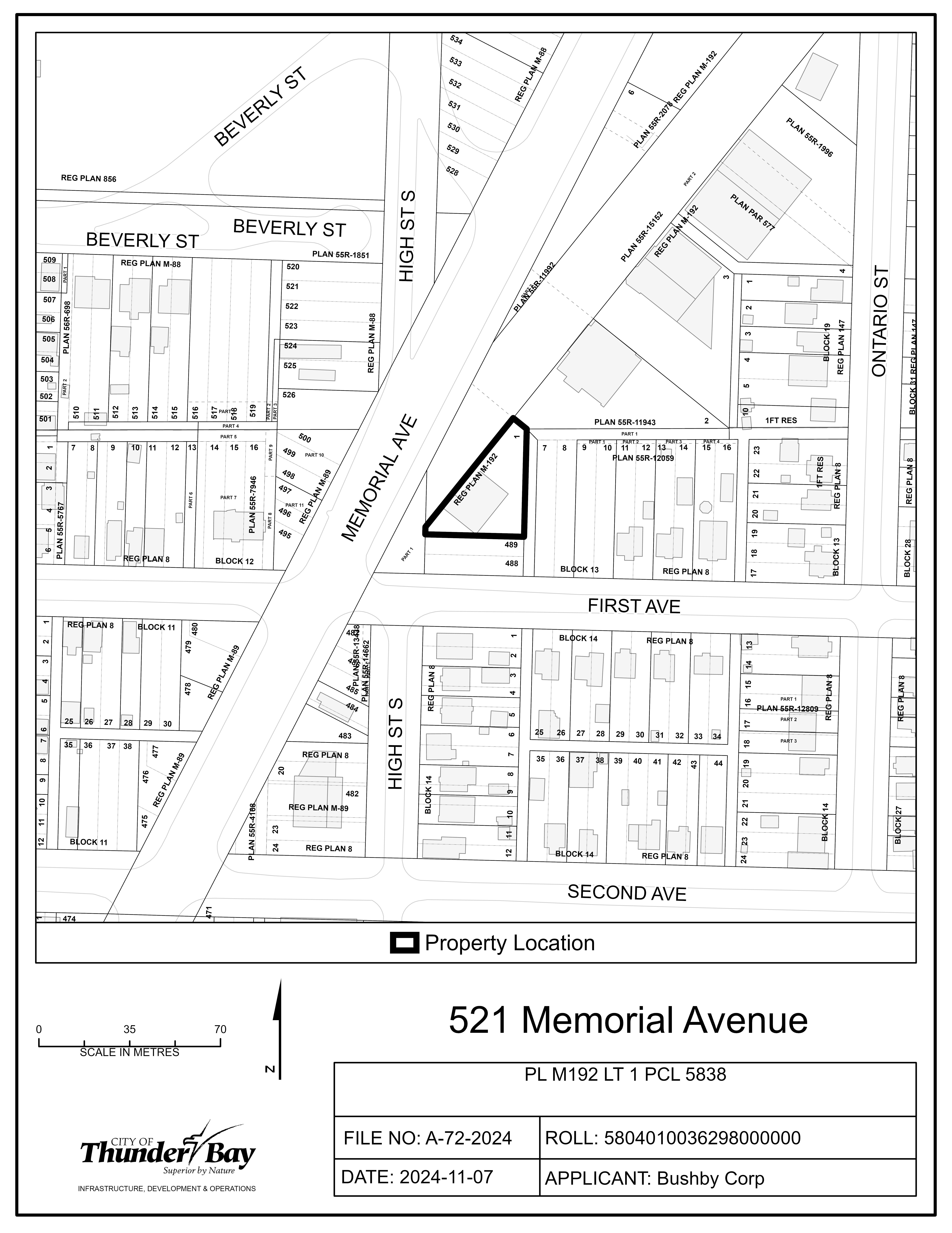
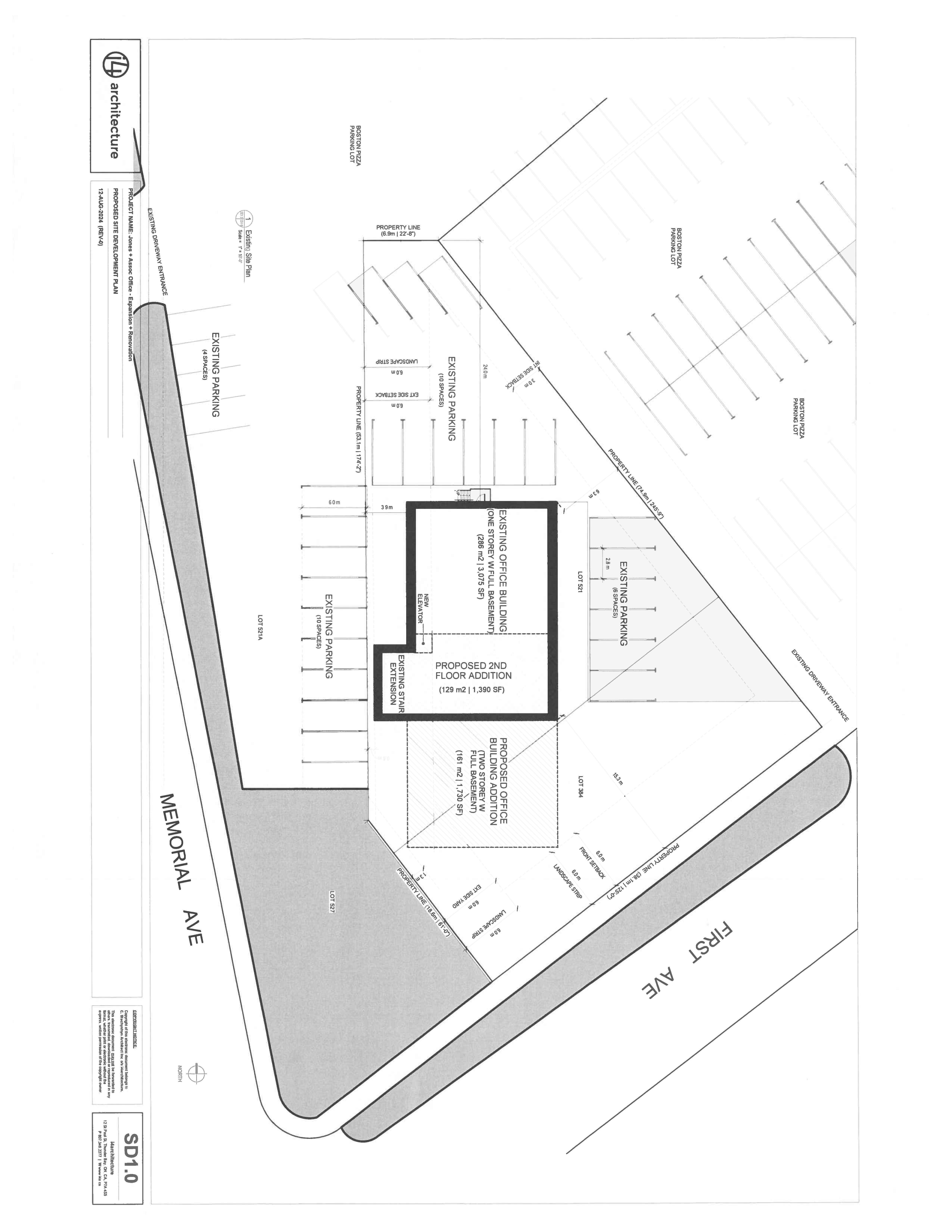
A-72-2024: 521 Memorial Avenue
The purpose and effect of the application is to gain relief from Zoning By-law 1-2022 as set forth in the application and described below:
- Table 5.1.1
- Reduce the minimum lot frontage from 20.0 m to 18.2 m
- Increase the maximum Gross Floor Area for an office from 500 m2 to 715 m2
- Table 5.2
- Reduce the minimum front setback from 6.0 m to 1.3 m
- Table 5.3
- Reduce the landscape strip along the westerly exterior lot line and rear lot line from 6.0 m to 0 m, and to reduce the landscape strip along the front lot line from 6.0 m to 1.3 m
- Reduce the number of parking spaces from 24 spaces (1 per 30 m2 of GFA) to 14 spaces
- Reduce the number of loading spaces from 1 space (1 per 500 m2 of GFA) to 0 loading spaces
If approved, the effect of this application would be the construction of an addition to the existing office, and to recognize the existing site conditions.
The lands are zoned "SC" - Service Commercial Zone and designated as "Service Commercial" in the Official Plan. The applicant's site sketch and a key map of the subject lands are shown below.
The subject lands are not subject to any other application under the Planning Act at this time.
Key Map of Subject Lands
Applicant's Site Sketch
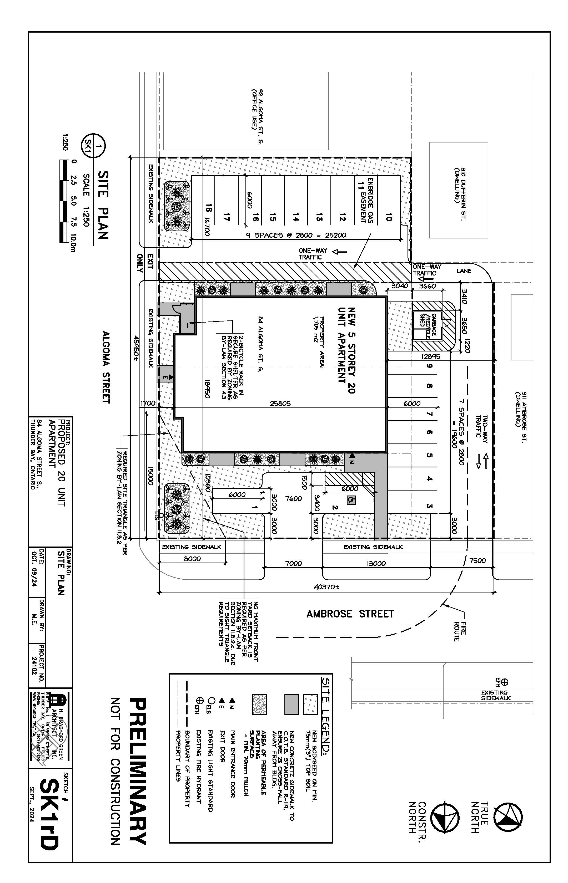
A-73-2024: 84 Algoma Street South
The purpose and effect of the application is to gain relief from Zoning By-law 1-2022 as set forth in the application and described below:
- Section 13.1.1
- Increase the maximum height from 10.0 m to 17.0 m
If approved, the effect of this application would be the construction of a 5 storey 20-unit residential apartment building.
The lands are zoned "DN" - Downtown Neighbourhood Zone and designated as "Strategic Core" in the Official Plan. The applicant's site sketch and a key map of the subject lands are shown below.
The subject lands are not subject to any other application under the Planning Act at this time.
Key Map of Subject Lands
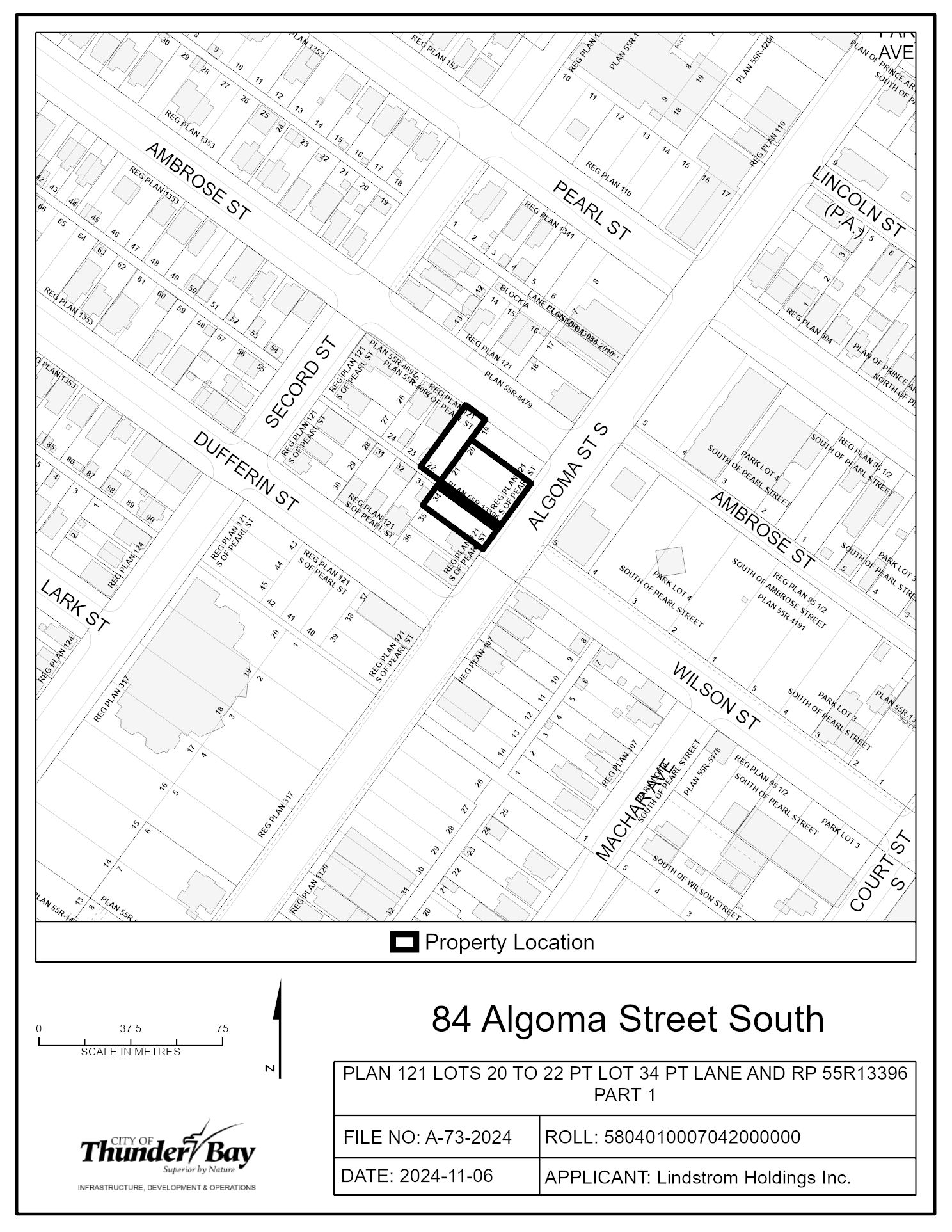
Applicant's Site Sketch
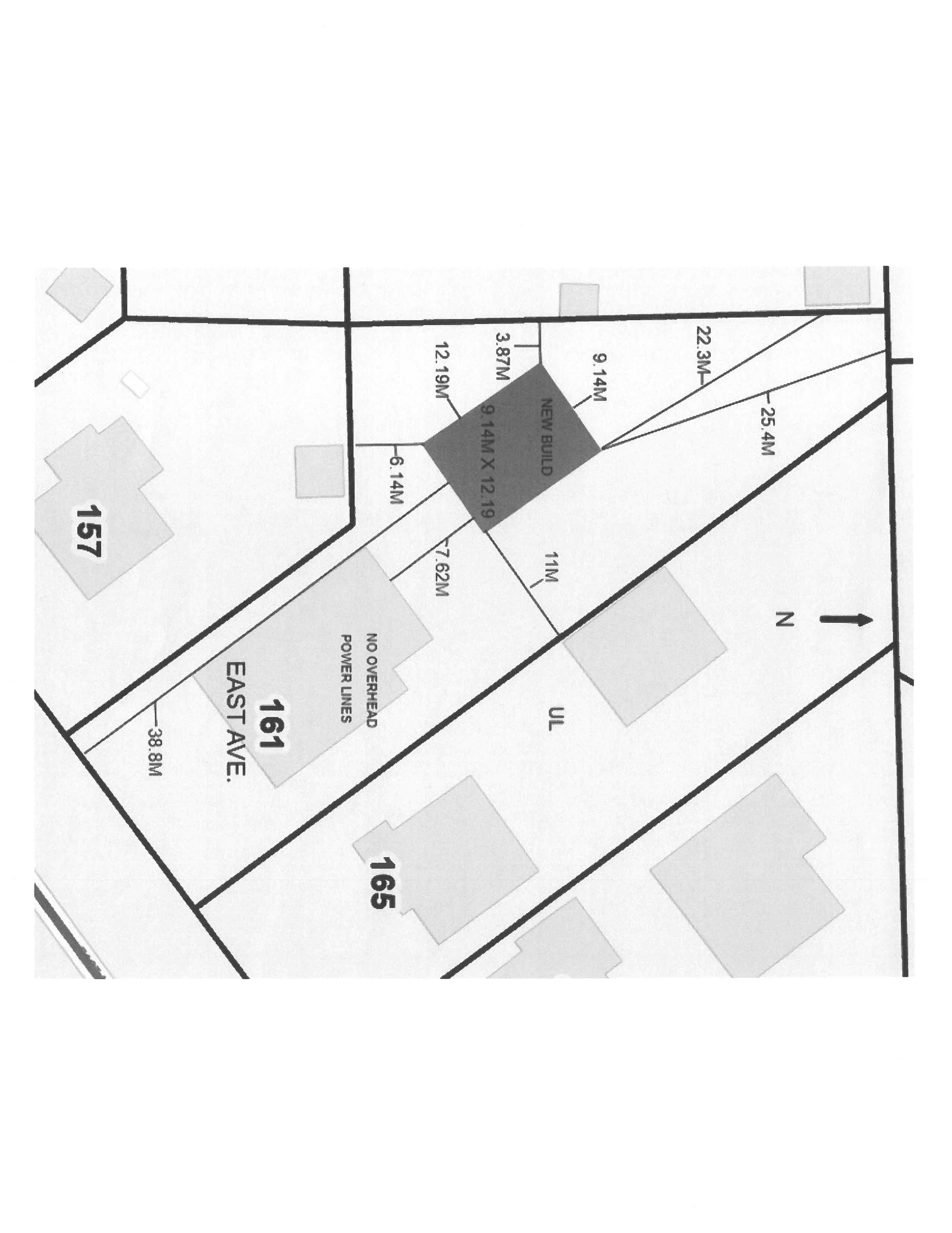
A-74-2024: 161 East Avenue
The purpose and effect of the application is to gain relief from Zoning By-law 1-2022 as set forth in the application and described below:
- Table 3.2.2
- Increase the maximum Gross Floor Area of an accessory building from 100 m2 to 111.48 m2
- Increase the maximum height of an accessory building from 4.6 m to 4.75 m
If approved, the effect of this application would be the construction of an accessory building.
The lands are zoned "UL" - Urban Low-rise Zone and designated as "Residential" in the Official Plan. The applicant's site sketch and a key map of the subject lands are shown below.
The subject lands are not subject to any other application under the Planning Act at this time.
Key Map of Subject Lands
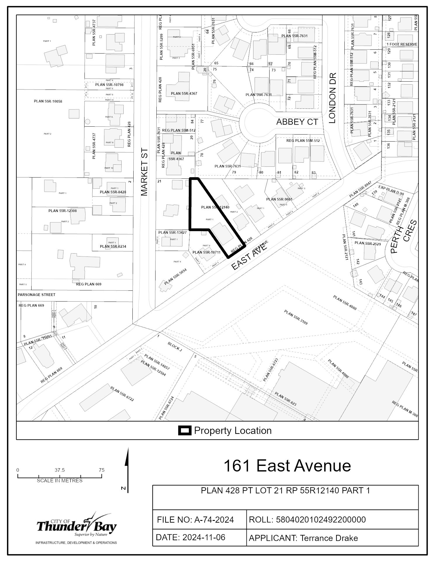
Applicant's Site Sketch
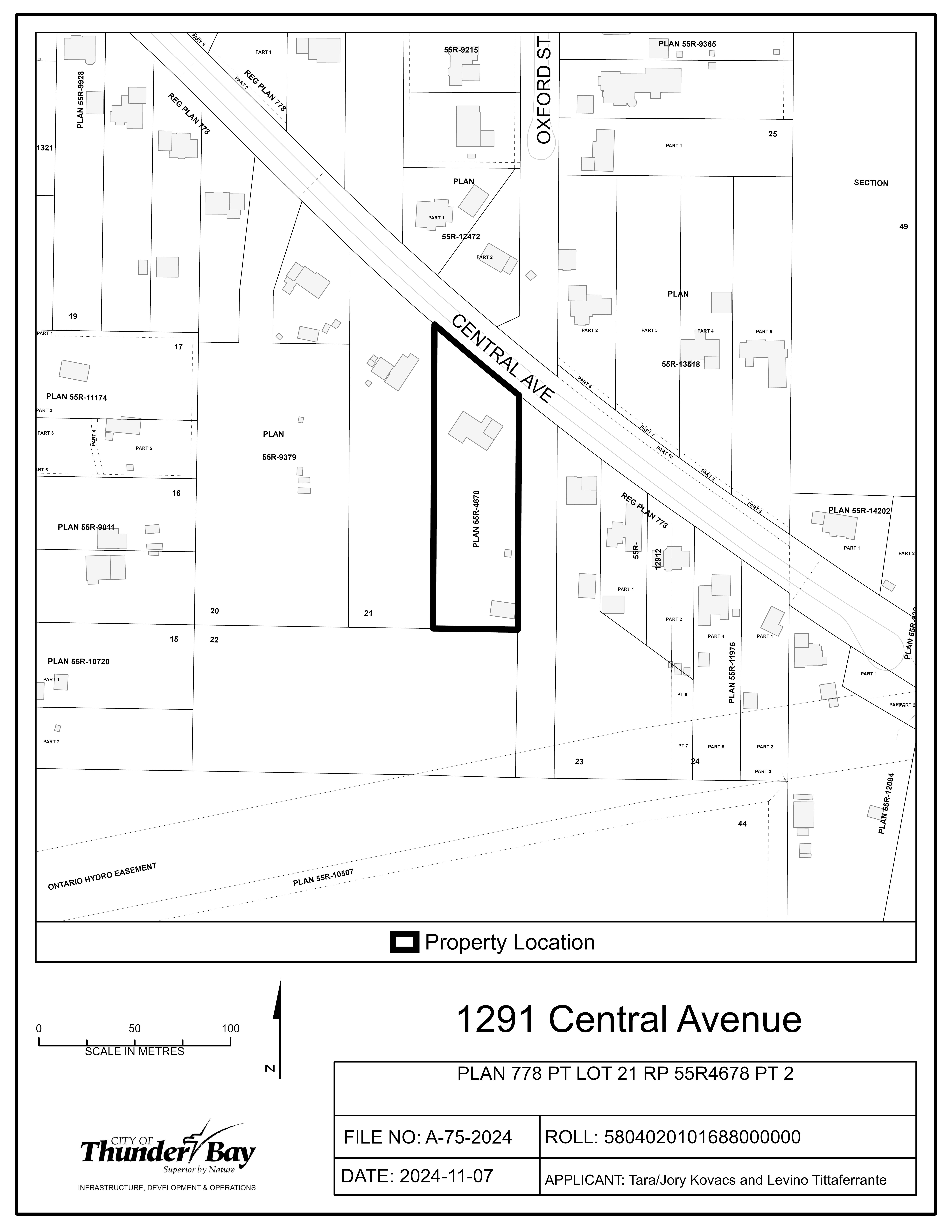
A-75-2024: 1291 Central Avenue
The purpose and effect of the application is to gain relief from Zoning By-law 1-2022 as set forth in the application and described below:
- Table 10.2.2
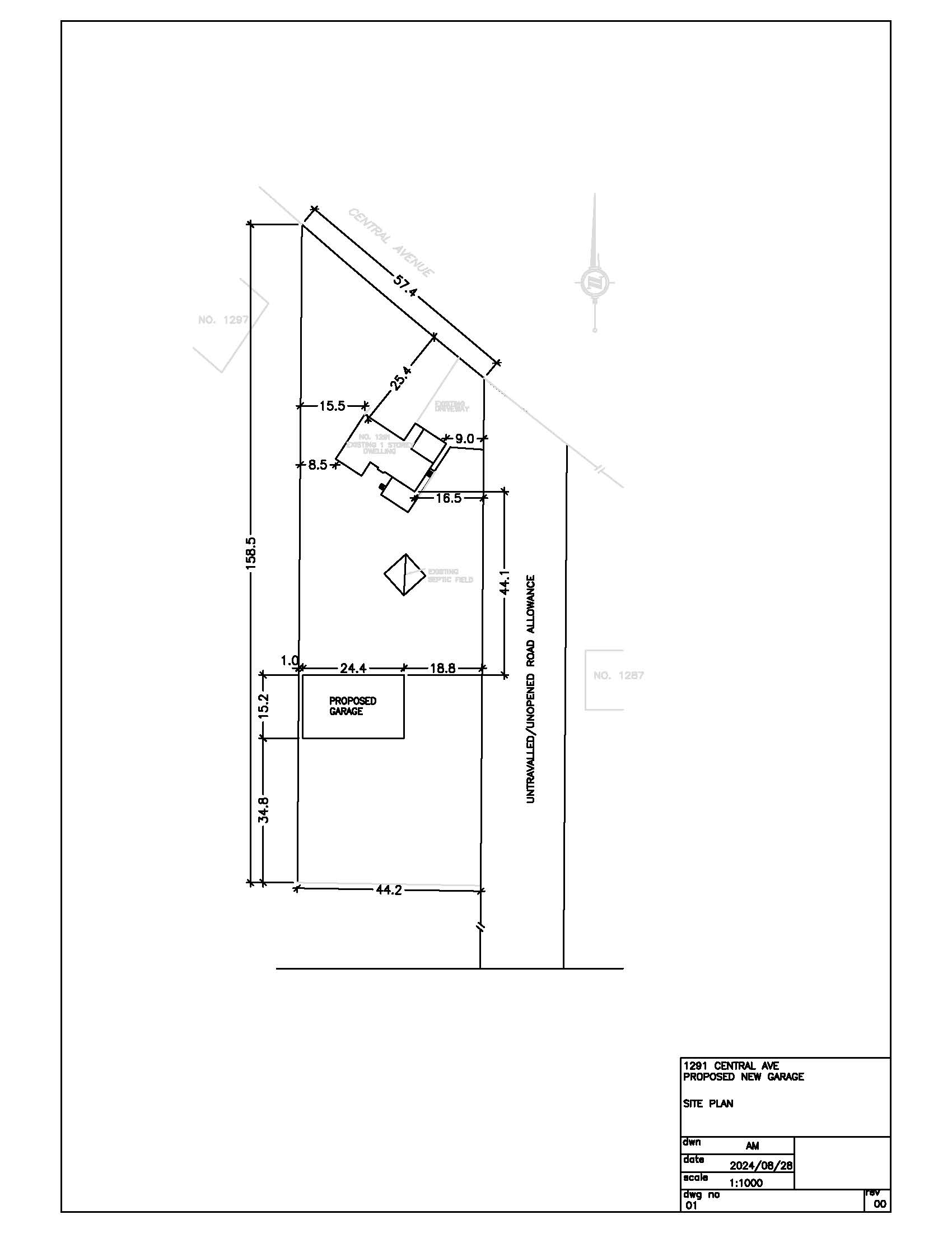
- Increase the maximum Gross Floor Area of all accessory buildings from 100 m2 to 370.88 m2
- Increase the maximum height of an accessory building from 4.6 m to 7.96 m
- Increase the maximum wall height of an accessory building from 3.2 m to 5 m
- Increase the maximum exterior side yard setback from 6.0 m to 18.8 m
If approved, the effect of this application would be the construction of an accessory building (15.2 m x 24.4 m)
The lands are zoned "UG" - Urban Growth Zone and designated as "Residential/Growth Area" in the Official Plan. The applicant's site sketch and a key map of the subject lands are shown below.
The subject lands are not subject to any other application under the Planning Act at this time.
Key Map of Subject Lands
Applicant's Site Sketch
Consent to Sever Applications
B-56-2024: 333 Sunflower Street
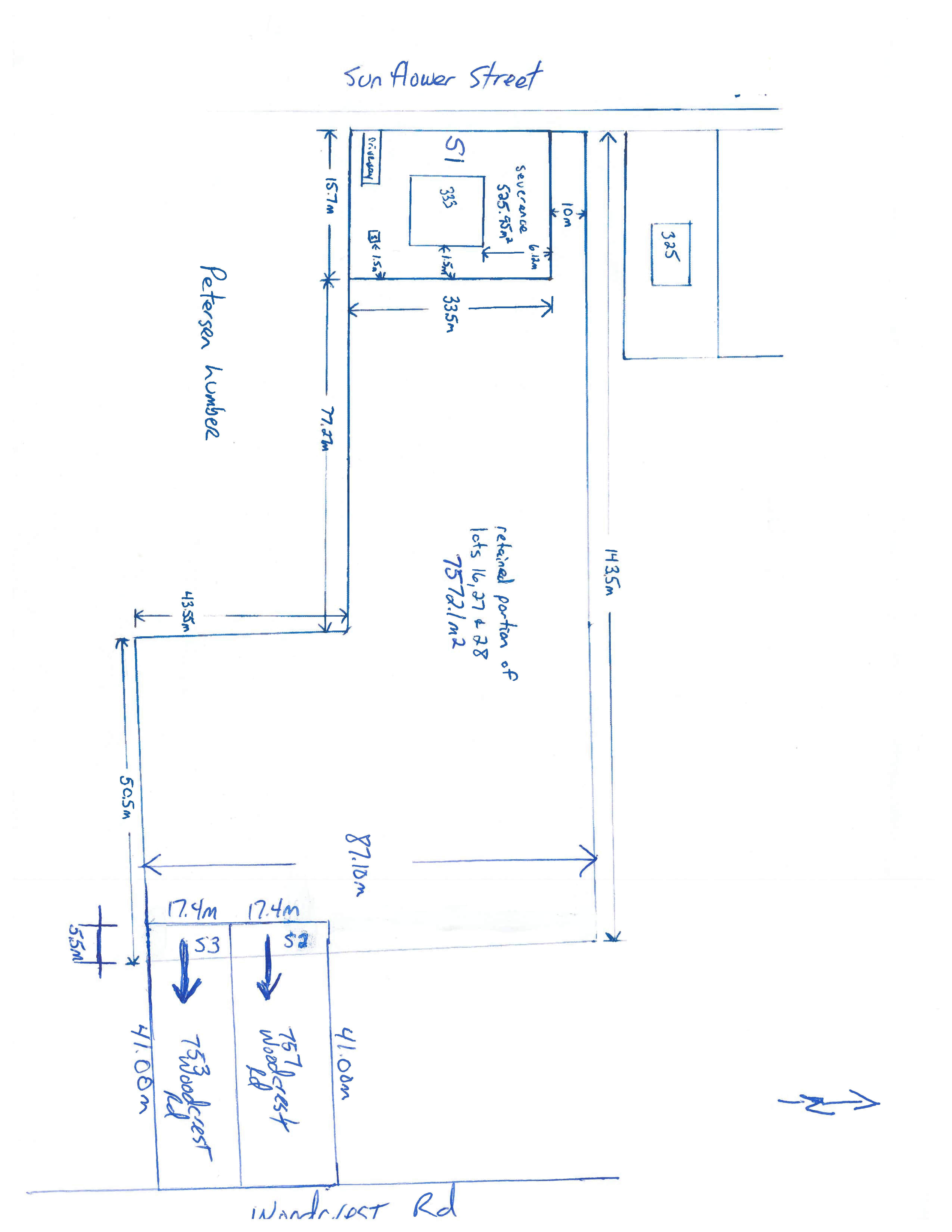
The purpose and effect of this application is to facilitate two lot additions where 17.4 m of frontage from 333 Sunflower Street would be added to 753 Woodcrest Road and 757 Woodcrest Road and the severance and conveyance of one lot and one retained.
Severed Lot 1 will have a lot frontage of 33.5 m, lot depth of 15.78 m, and a lot area of 525.95 m2
Severed Lot 2 will have a lot frontage of 17.4 m, lot depth of 46.5 m, and a lot area of 809.1 m2
Severed Lot 3 will have a lot frontage of 17.4 m, lot depth of 46.5 m, and a lot area of 809.1 m2
The Retained Lot will have a lot frontage of 10.5 m, an irregular lot depth, and a lot area of 7,572.06 m2
If approved, the effect of this application would be the increase in lot area, creation of severed lot 1 and lot area increase to severed lots 2 and 3, as set forth in the application.
The lands are zoned "UL" - Urban Low-rise Zone and "ULH1" - Urban Low-rise Zone, subject to holding provision number 1, and designated as "Residential" in the Official Plan. The applicant's site sketch and a key map of the subject lands are shown below.
The subject lands are not subject to any other application under the Planning Act at this time.
Key Map of Subject Lands

Applicant's Site Sketch
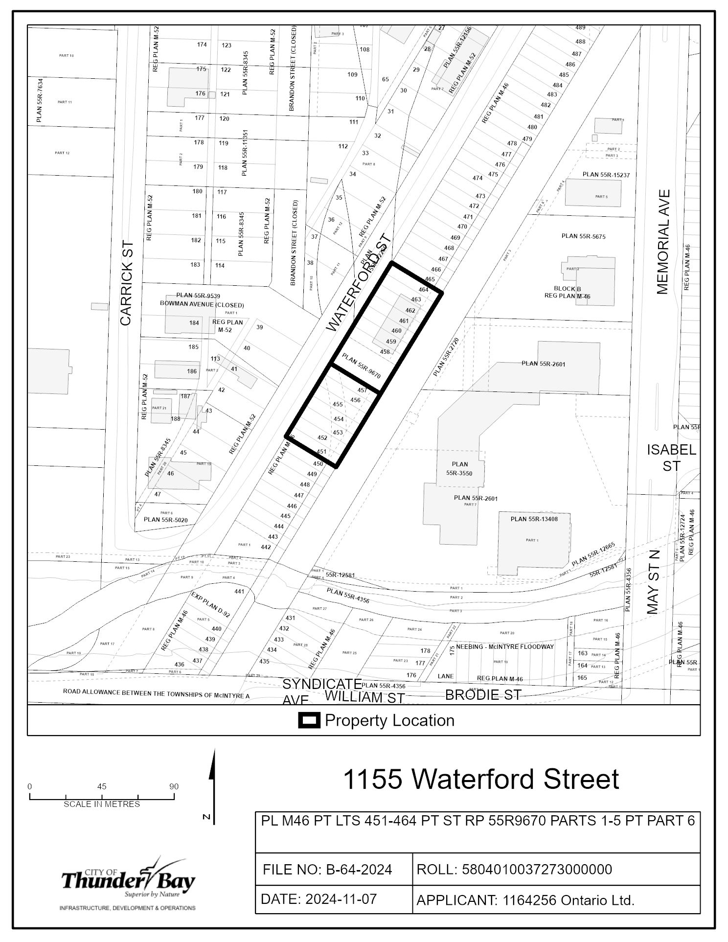
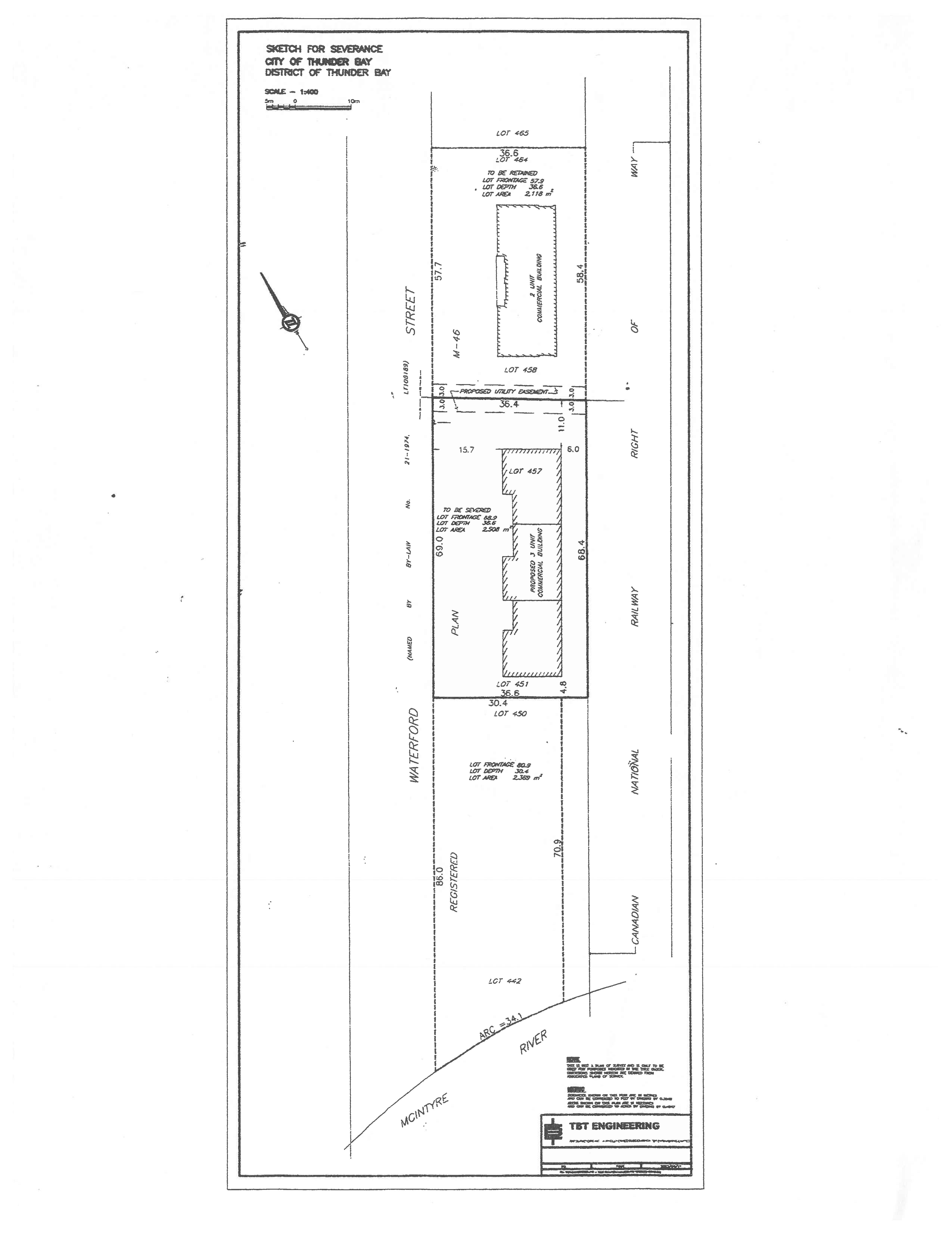
B-64-2024: 1155 Waterford Street
The purpose and effect of this application is to create one new parcel of land.
The Severed Lot will have a lot frontage of 69 m, lot depth of 36.4 m, and a lot area of 2,508 m2
The Retained Lot will have a lot frontage of 57.7 m, lot depth of 36.4 m, and a lot area of 2,118 m2
If approved, the effect of this application would be the severance and conveyance of one new parcel of land for future development of a 3-unit commercial development and to establish any easements as may be required for servicing, as set forth in the application.
The lands are zoned "LI" - Light Industrial Zone and designated as "Light Industrial" in the Official Plan. The applicant's site sketch and a key map of the subject lands are shown below.
The subject lands are not subject to any other application under the Planning Act at this time.
Key Map of Subject Lands
Applicant's Site Sketch
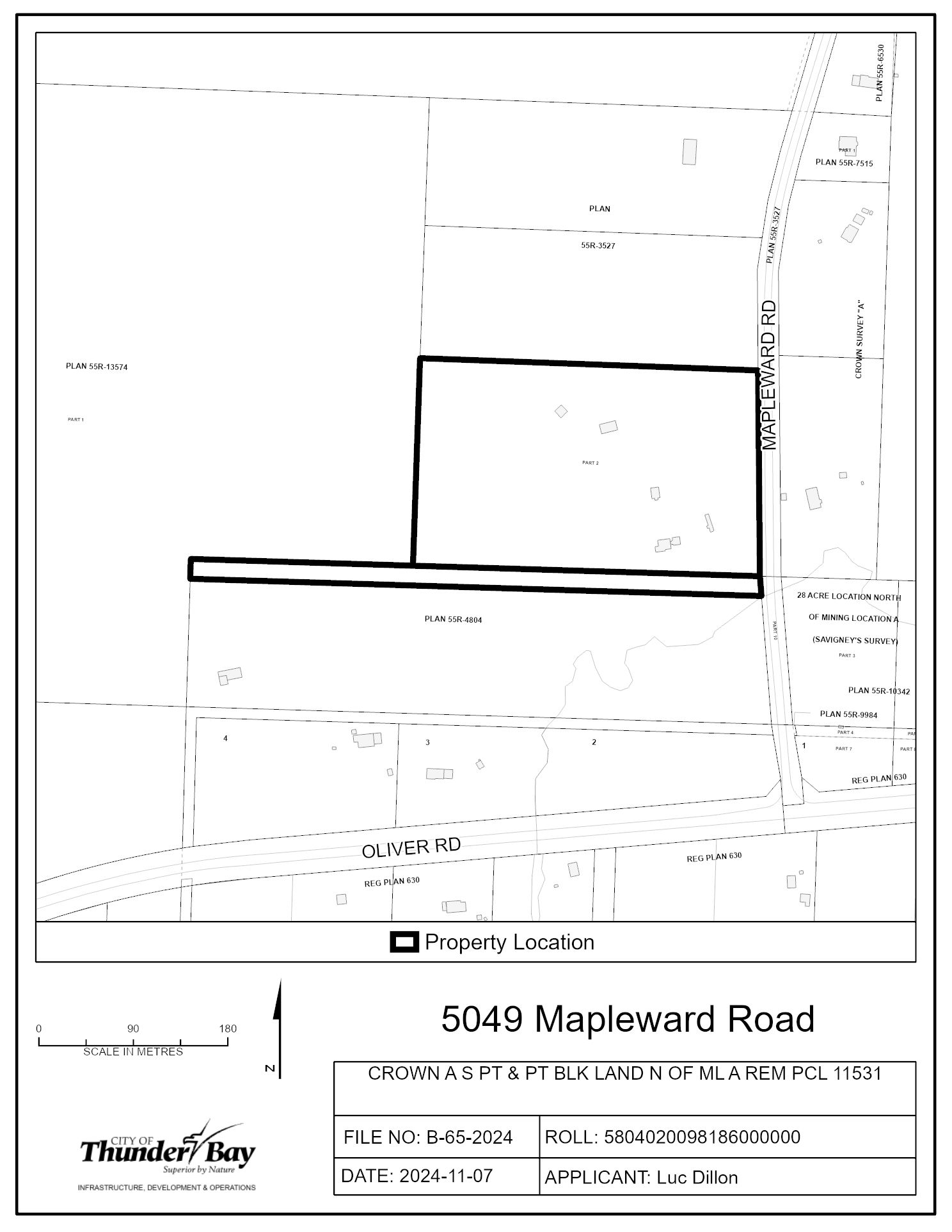
B-65-2024: 5049 Mapleward Road
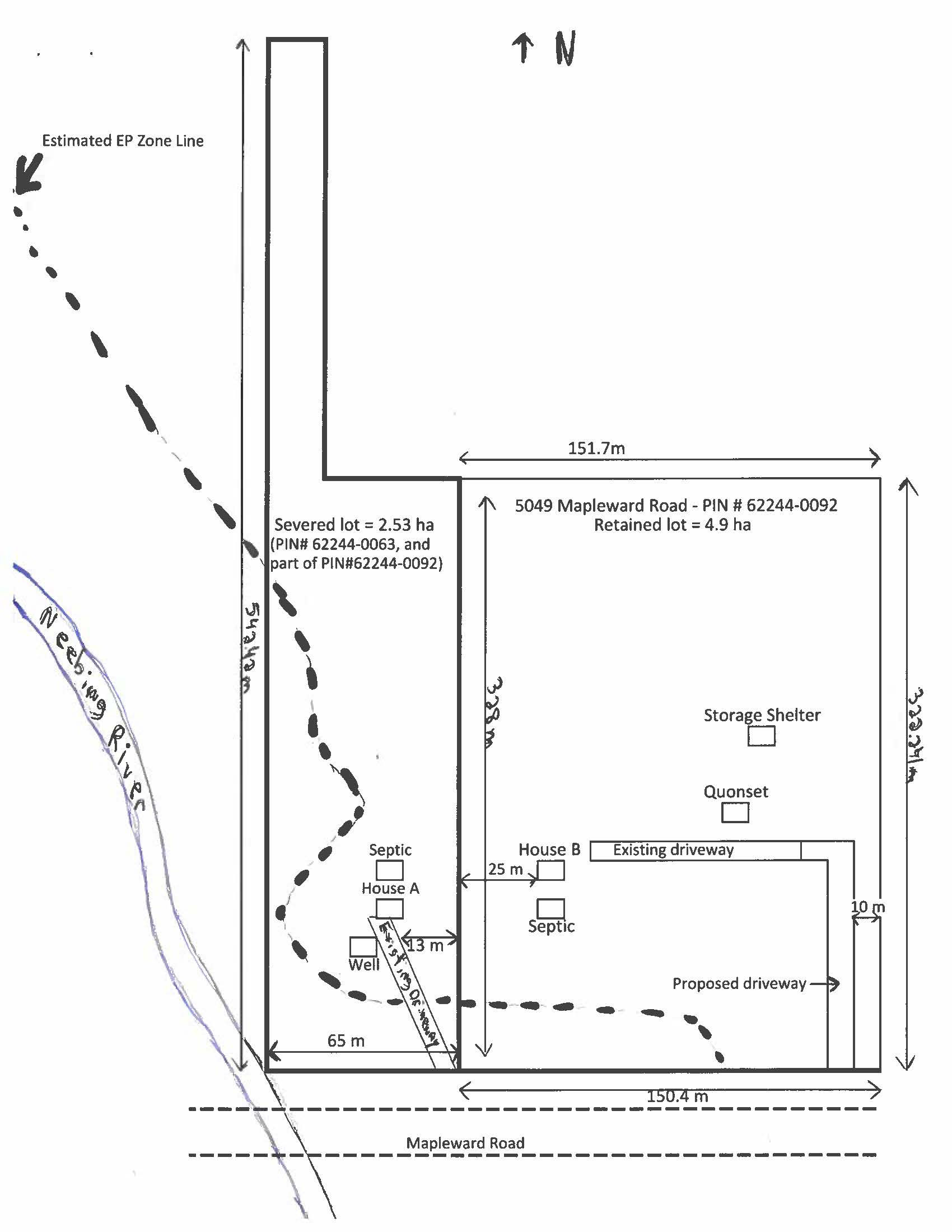
The purpose and effect of this application is to create one new parcel of land so that the two existing detached houses can be located on separate parcels of land.
The Severed Lot will have a lot frontage of 65 m, an irregular lot depth, and a lot area of 25,300 m2
The Retained Lot will have a lot frontage of 150 m, an irregular lot depth, and a lot area of 49,000 m2
If approved, the effect of this application would be the severance and conveyance of one new parcel of land and to establish any easements as may be required for servicing, as set forth in the application.
The lands are zoned "RUH15" - Rural Zone, with development holding provision number 15, and designated as "Rural 1", "Evaluated Wetland", and "Natural Corridor" in the Official Plan. The applicant's site sketch and a key map of the subject lands are shown below.
The property was subject to an approved Official Plan Amendment, file O-07-2024, to create policy to support/allow for an additional severance to create one new parcel of land that exceeds the two-lot creation limit and to allow for a retained parcel that has a lot area of 4.3 hectares outside of the "EP" - Environmental Protection Zone instead of the required 5 hectares.
The subject lands are not subject to any other application under the Planning Act at this time.
Key Map of Subject Lands
Applicant's Site Sketch
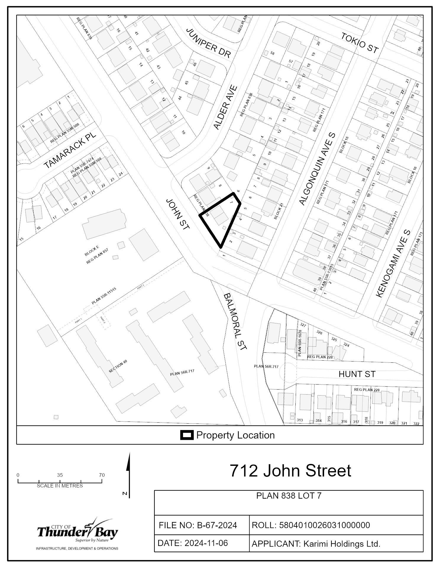
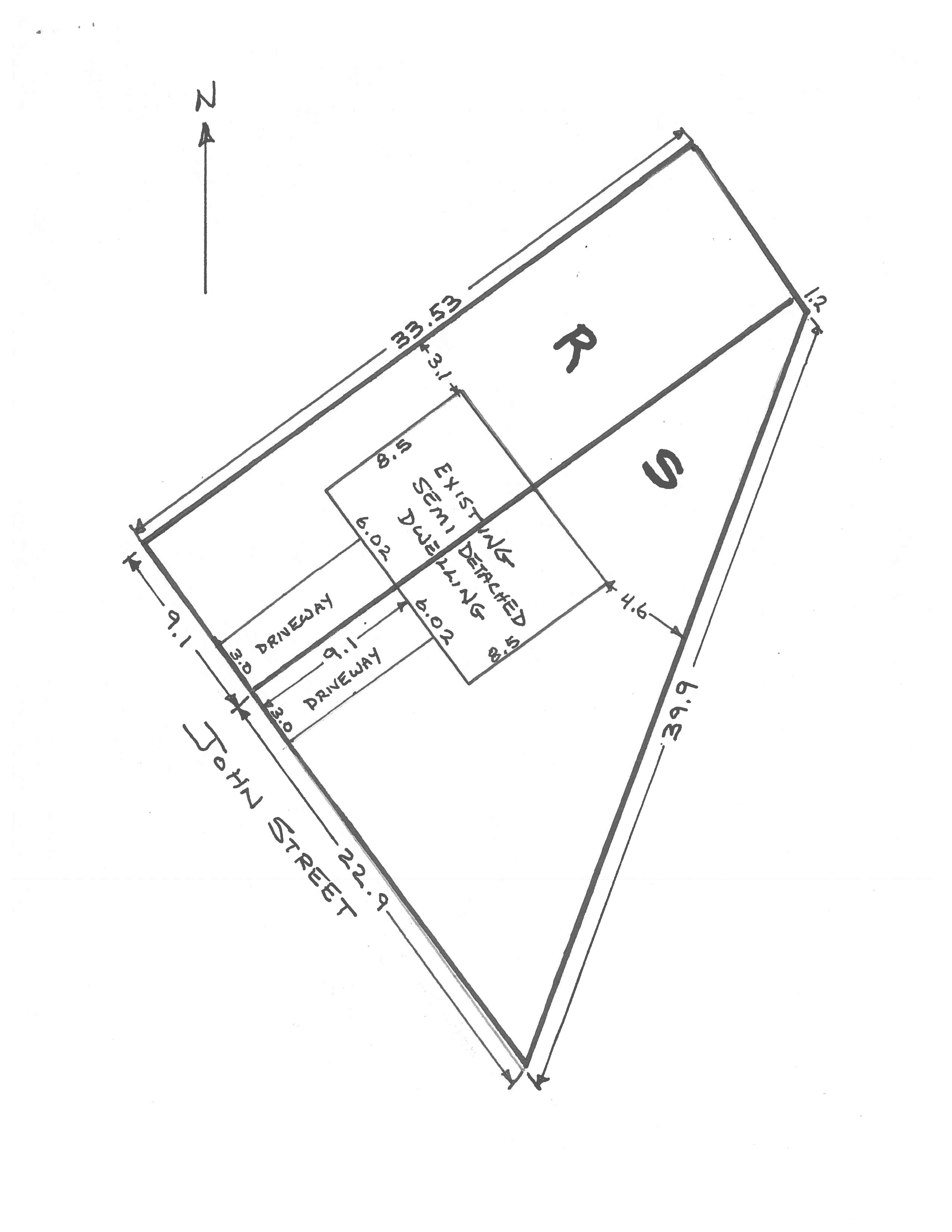
B-67-2024: 712 & 714 John Street
The purpose and effect of this application is to create one new parcel of land.
The Severed Lot will have a lot frontage of 22.9 m, an irregular lot depth, and a lot area of 787.6 m2
The Retained Lot will have a lot frontage of 9.1 m, lot depth of 33.53 m, and a lot area of 305.1 m2
If approved, the effect of this application would be the severance and conveyance of one-half or a semi-detached dwelling and to establish any easements as may be required for servicing, as set forth in the application.
The lands are zoned "UL" - Urban Low-rise Zone and designated as "Residential" in the Official Plan. The applicant's site sketch and a key map of the subject lands are shown below.
The subject lands are not subject to any other application under the Planning Act at this time.
Key Map of Subject Lands
Applicant's Site Sketch
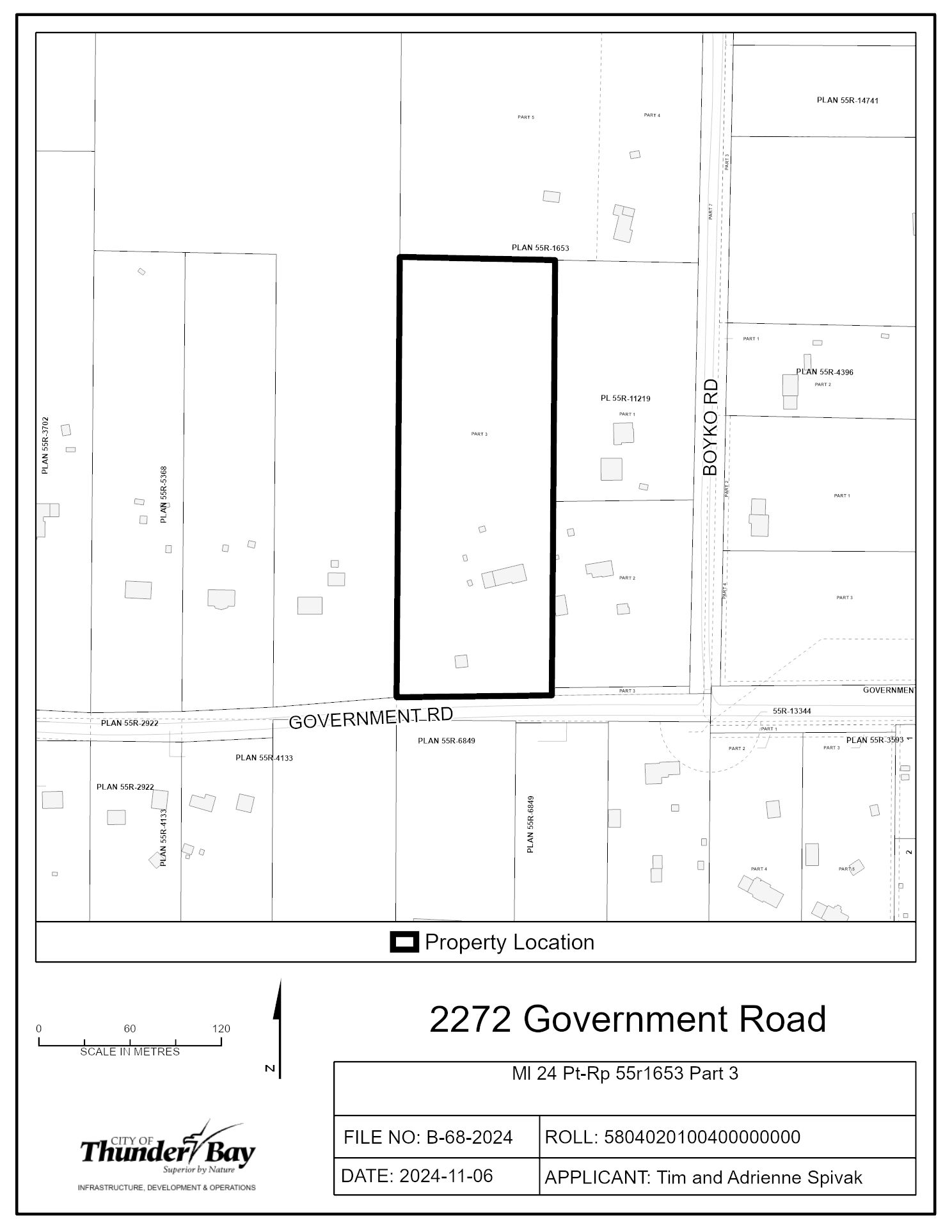
B-68-2024: 2272 Government Road
The purpose and effect of this application is to create one new build-able lot on private services.
The Severed Lot will have a lot frontage of 50.99 m, lot depth of 289.35 m, and a lot area of 14,753.96 m2
The Retained Lot will have a lot frontage of 50.99 m, lot depth of 289.35 m, and a lot area of 14,753.96 m2
If approved, the effect of this application would be to allow for the severance and conveyance of one new parcel and for the construction of a new residential dwelling.
The lands are zoned “RU – Rural Zone” and “RUH15 – Rural Zone with Holding Provision 15” in the Zoning By-law 1-2022, and designated as “Rural” and “Natural Heritage” in the Official Plan. The applicant’s site sketch and a key map of the subject lands are shown below.
The subject lands are also the subject of an application for a Minor Variance, File no. A-69-2024, which is being considered concurrently by the Committee of Adjustment on November 28, 2024.
Key Map of Subject Lands
Applicant's Site Sketch
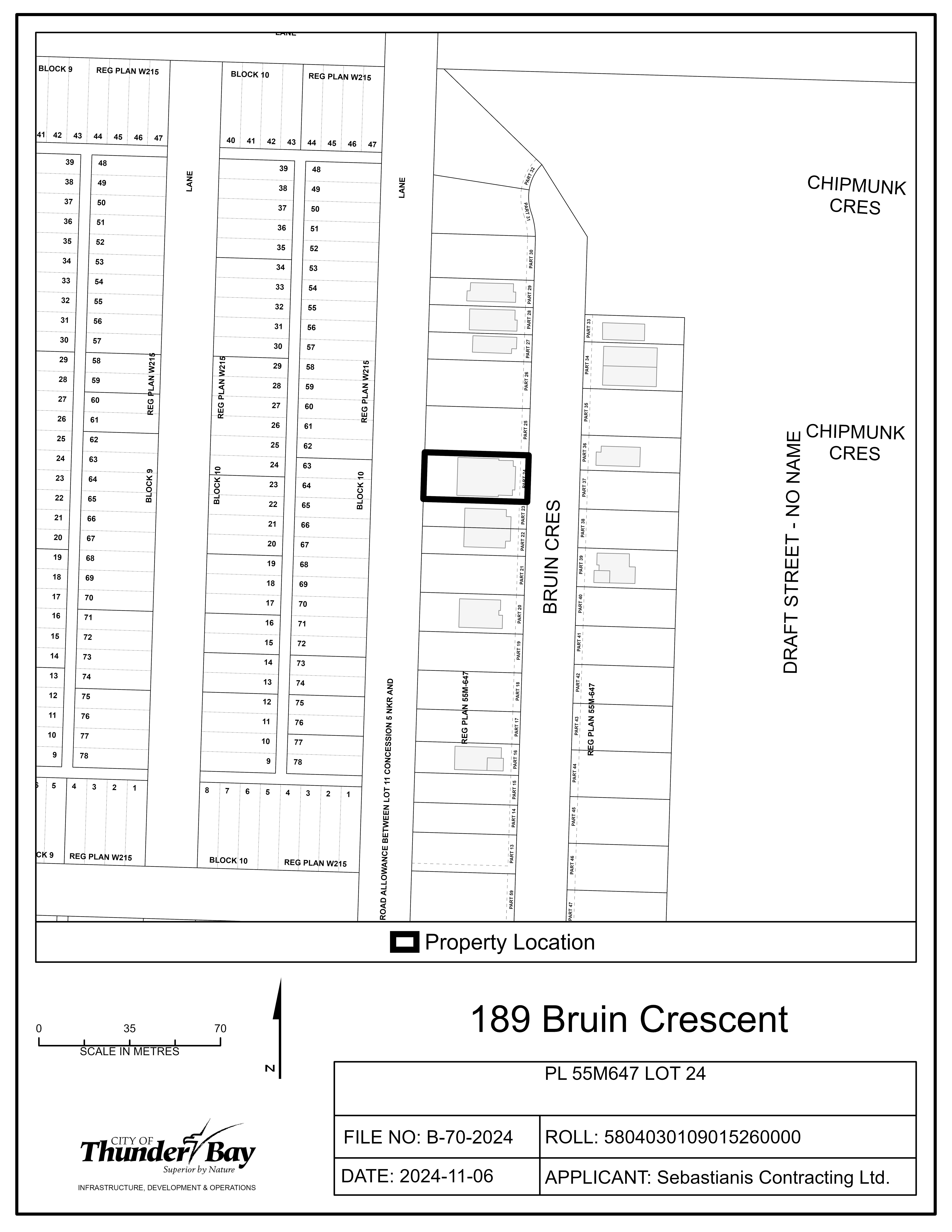
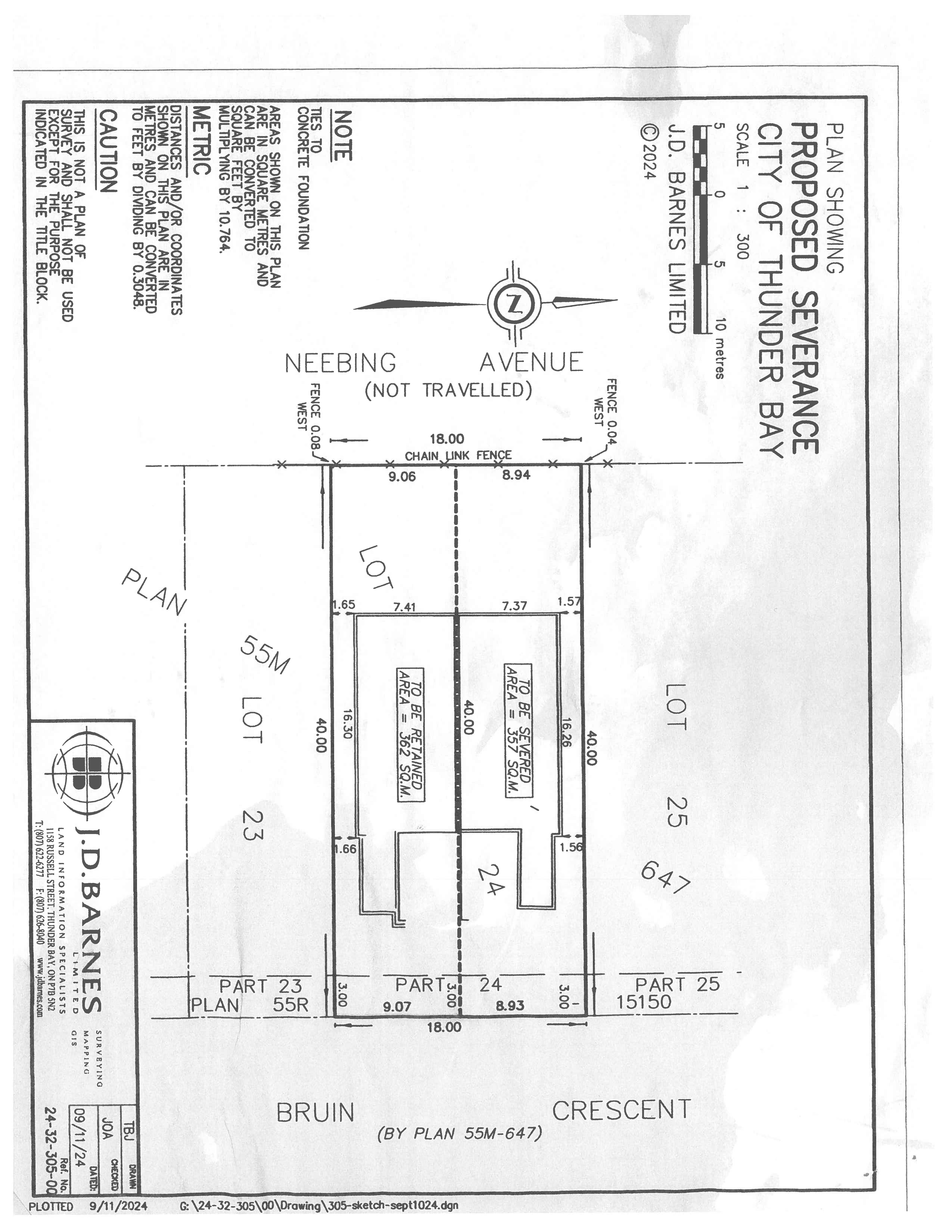
B-70-2024: 189 Bruin Crescent
The purpose and effect of this application is to create one new parcel of land.
The Severed Lot will have a lot frontage of 8.93 m, a lot depth of 40 m, and a lot area of 357 m2
The Retained Lot will have a lot frontage of 9.07 m, lot depth of 40 m, and a lot area of 362 m2
If approved, the effect of this application would be the severance and conveyance of one-half or a semi-detached dwelling and to establish any easements as may be required for servicing, as set forth in the application.
The lands are zoned "UL" - Urban Low-rise Zone and designated as "Residential" in the Official Plan. The applicant's site sketch and a key map of the subject lands are shown below.
The subject lands are not subject to any other application under the Planning Act at this time.
Key Map of Subject Lands
Applicant's Site Sketch
Contact Us


